


Castle Rock A Precinct, Scotts Bluff County, Nebraska
About
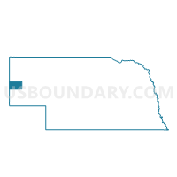
Outline

Summary
| Unique Area Identifier | 613903 |
| Name | Castle Rock A Precinct |
| County | Scotts Bluff County |
| State | Nebraska |
| Area (square miles) | 44.18 |
| Land Area (square miles) | 44.09 |
| Water Area (square miles) | 0.09 |
| % of Land Area | 99.79 |
| % of Water Area | 0.21 |
| Latitude of the Internal Point | 41.74876590 |
| Longtitude of the Internal Point | -103.54718940 |
Maps


Graphs
Select a template below for downloading or customizing gragh for Castle Rock A Precinct, Scotts Bluff County, Nebraska


Neighbors
Neighoring Voting District (by Name) Neighboring Voting District on the Map
- Castle Rock B Precinct, Scotts Bluff County, NE
- Dewey-Tabor Precinct, Scotts Bluff County, NE
- Gering Precinct, Scotts Bluff County, NE
- Highland Precinct, Scotts Bluff County, NE
- Long Springs Precinct, Banner County, NE
Top 10 Neighboring County Subdivision (by Population) Neighboring County Subdivision on the Map
- Gering precinct, Scotts Bluff County, NE (2,208)
- Dewey Tabor precinct, Scotts Bluff County, NE (1,776)
- Long Springs precinct, Banner County, NE (690)
- East Winters Creek precinct, Scotts Bluff County, NE (608)
- Castle Rock precinct, Scotts Bluff County, NE (606)
- Highland precinct, Scotts Bluff County, NE (444)
Top 10 Neighboring Place (by Population) Neighboring Place on the Map
Top 10 Neighboring Unified School District (by Population) Neighboring Unified School District on the Map
- Scottsbluff Public Schools, NE (19,048)
- Gering Public Schools, NE (11,327)
- Bayard Public Schools, NE (2,378)
- Minatare Public Schools, NE (930)
- Banner County Public Schools, NE (747)
Top 10 Neighboring State Legislative District Upper Chamber (by Population) Neighboring State Legislative District Upper Chamber on the Map
- State Senate District 48, NE (33,594)
- State Senate District 47, NE (32,377)
- State Senate District 49, NE (31,705)
Top 10 Neighboring 111th Congressional District (by Population) Neighboring 111th Congressional District on the Map
Top 10 Neighboring Census Tract (by Population) Neighboring Census Tract on the Map
- Census Tract 9538, Scotts Bluff County, NE (4,854)
- Census Tract 9529, Scotts Bluff County, NE (2,781)
- Census Tract 9532, Scotts Bluff County, NE (1,524)
- Census Tract 9540, Banner County, NE (690)
Top 10 Neighboring 5-Digit ZIP Code Tabulation Area (by Population) Neighboring 5-Digit ZIP Code Tabulation Area on the Map
- 69361, NE (17,999)
- 69341, NE (11,165)
- 69334, NE (2,351)
- 69356, NE (1,882)
- 69345, NE (455)
- 69355, NE (115)